Category Archives: Travel

Irish Nuances – An American Perspecitive

My wife Cyndie and I recently returned from a trip to Ireland (both Northern Ireland and the Republic of Ireland).  It was twelve days of wondrous discovery and eye-gripping scenery.  Aside from all the wonder, there were a few observations I feel worth sharing.  Here they are in no particular order:

  • I found no car window scrubber at any filling station to clean the car windows.
  • Bathrooms = Toilets.  At filling stations they are typically located outside; around back or along the side of the building.
  • A large coffee is equivalent to a small in the USA.

    2016-04-28 iPhone Ireland 2016-3660
    Large coffee :-/
  • I would recommend bringing a travel mug or small thermos for coffee.  You never know when you will run into the next filling station or coffee shop.  A “large” coffee doesn’t go far.
  • Coffee in Ireland is fantastic – at filling stations too.  Coffee at the B&B’s is phenomenal.  You may want to fill that mug/thermos at the B&B before you leave.
  • Water – we stopped at the first filling station we saw and bought a case of water.  Repeat as needed.   There are many sites where you will likely need to hike.  Always have water on hand.
  • Most filling stations sell alcohol.  Pick up some hard cider for an evening cocktail back at the B&B.
  • If you rent an automatic diesel car, when you apply the brake and stop, the engine will turn off.  Do not be alarmed, when you take your foot off the brake, the engine will start again.
  • I highly recommend renting a GPS navigation device.
  • Look for a flag when entering an address on the GPS device to indicate which county you wish to navigate in – Republic of Ireland or Northern Ireland.

    2016-04-28 iPhone Ireland 2016-3639
    Huge time-saver
  • A portable WiFi device can be very useful.  Be aware, though, that if rent it in the Republic of Ireland, it will not work in Northern Ireland.  I would imagine the inverse would be true as well.  WiFi access is nice when traveling from town to town to locate sites you wish to visit or what restaurants are available.  Be sure to read the reviews.
    Image result for hertz portable wifi
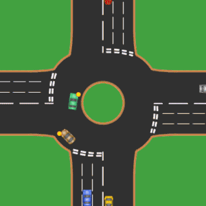
  • Round-a-bouts (GPS refers to them as rotary) are not that hard to navigate; the key is to enter them in the correct lane and signal appropriately to exit.  Learn this quickly as you will encounter many of them.
  • If someone recommends visiting the chemists, they are referring to the drug store/pharmacy.
  • When dinning out, ask for your check as they do not automatically drop it by your table.  In most instances you do not pay your waiter/waitress; you pay at the bar/bartender.
  • When stopping at a filling station, presumably in smaller towns, always check to make sure their credit card machine is operational (or carry adequate cash).
  • Recognize the difference between the color of pump handle that corresponds to the correct fuel for your car.  Green handle is diesel in USA, but in Ireland it is petrol (Unleaded).  Black is typically diesel in Ireland.

    diesel vs. regular
    Diesel is the BLACK handle!
  • Attractions and some ferries are cash only.
  • Make sure your credit and debit cards are chip.  If you need a PIN for your credit card be sure to request it well in advance of your trip (typically 10 days to get).  No PIN needed for purchases – just for cash.
  • The B&B network is extensive and a great way to travel.  I would recommend making reservations for the latest possible arrival time as each B&B allows.  That gives you some wiggle room as you travel from town to town.
  • We didn’t not purchase a phone to use while in Ireland.  We kept our iPhones in “Airplane Mode” the entire time and connected to WiFi (both portable or at location where we stayed/ate).  This was only an issue once when we were running behind schedule getting to our B&B.  I sent them an email earlier in the day requesting a later arrival time, but they didn’t see it.  There are pay phone in most town centers, but not at every filling station.
  • If you are going for an extended amount of time and wish to minimize luggage, use a laundry service.  Be advised that you typically need to drop off in the a.m. and pick up the following a.m. so plan accordingly.
  • POWER – we purchased a BESTEK 200W Travel Voltage Converter with 6A 4 USB Charging Ports.  The USB ports were handy for charging our iPhones and portable WiFi device.  The 110 outlets worked great for charging camera batteries and laptop.  This is only for electronics.
  • We also purchased Ceptics Grounded Universal Plug Adapter for UK (Type G) – 3 Pack for my CPAP machine and Cyndie’s curling iron.   If your curling iron dies, go see the chemists for a new one.  Approx 30 Euro.
  • Take full advantage of the traditional Irish breakfast.  It is typically large and very tasty.  It usually starts with cold cereal/yogurt & granola,  juice, bread and fruit; then the hot stuff – eggs, bacon, sausage, tomato, black/white pudding, toast and coffee.  This will carry you through the day well.  Have a snack in the afternoon and a pint and you are set until dinner.

    2016-04-28 iPhone Ireland 2016-2906
    Traditional Irish Breakfast @ Kilmail Country Chalet
  • Fresh seafood and fish is available on every coast.  We didn’t find a bad Fish & Chips anywhere.  A good variety of fish to – Sea Bass, Hake, Cod, Monk Fish, Haddock, etc.

    Filet of Sea Bass
    Filet of Sea Bass
  • I was surprised that I only found Bangers & Mash and Corn Beef & Cabbage at one restaurant each.  Perhaps these dishes are more readily available in pubs.  Not all pubs serve food though.  If you are looking to eat specific things you may want to research what is available where you will be traveling.  If you are interested in eating lamb you are in luck.  That was served in some form everywhere we stayed.
  • If you desire Almonds while on your trip, pack them, as they were not readily available anywhere.  Dry roasted peanuts were however plentiful and a satisfactory substitute.
  • The travel neck pillow you purchased at the airport makes and excellent cradle for you DSLR camera while driving around the Irish countrysides.  You’ll likely be stopping often and packing it away each time in your camera bag just isn’t practical.
    2016-04-28 iPhone Ireland 2016-3411
  • I don’t believe tipping is customary in Ireland, but it is greatly appreciated.  I’ve never been waiting on more quickly and cheerfully every place we had a pint and/or had dinner.
  • And finally, enjoy plenty of Guinness & Bulmers on your travels.  No where will it taste fresher than from the motherland itself.
    2016-04-28 iPhone Ireland 2016-2982

See more of Republic of Ireland 

See more of Northern Ireland

iPhone 6S for travel photography

iPhone 6S Camera App

My wife and I recently visited Northern Ireland and the Republic of Ireland.  We traveled around the entire island.  As you can imagine, the scenery and sites where quite picturesque.

4k (1)
Image from petapixel.com

Just before leaving on our trip we upgraded our iPhone from 5S to 6S.  I was and continue to be very impressed with this rendition.  The camera stills and 4k video are outstanding.  We opted for the 64GB model thinking we didn’t want to run out of space due to large amount of photos and videos.  We didn’t even come close; a 32GB model would have suffice, but that is no longer an option.  In total, I alone shot 77 panoramas, 35 Selfies, 22 Videos and hundreds of other photos.

The panorama feature is by far my favorite.  As a photographer that has shot, stitched and edit numerous panorama’s from a DSLRs files – using an iPhone for this purpose is almost effortless.

12 day photo map
Map Module in LR

Another wonderful feature is the geo tagging of every photo.  The GPS data is nice to have when you import all of your photos into Lightroom.  The Map Module quickly and easily displays all of the location your used your iPhone.  I do have a GPS device for our Nikon DLS.  The Nikon GP-1A GPS Unit seemingly takes a while to lock in its position.  I don’t want to spend my time waiting on a green light to take a photo.  I leave it home more frequently now that I shoot with both my DSLR and iPhone.

Image from digital-photography-school.com

Our Nikon D700 and iPhone 6S each have a 12MP sensor.  Hard to believe.  The sensors are very different though.  The D700 sensor measures 36x24mm and the iPhone just 4.8×3.6mm.  I am amazed at the quality that something so tiny can produce; however, It does have many limitation.  It doesn’t even begin to perform as well as the larger one.  Low light, action and overall quality are very different.  But when you consider ease of use, size, and the complete package the iPhone places in your finger tips; in my opinion it is hard not to consider it a serious camera for traveling and a complete replacement for a point and shoot camera altogether.  With the addition of a third party camera app like ProCamera, you have most manual setting at your fingertips.  I like ProCamera as it also allows you to insert your copyright info into the EXIF data of every image.

A new feature on the recent iPhone release is Live Photo.  It is an interesting and entertaining feature.  The result is both an image file and movie file; when you import the photo into Lightroom, the .jpg is hidden.  Your options and solution to this issue can be found [here].

Stay tuned for deluge of photos I captured while on holiday in Ireland.  I’ve reviewed and processed all the photos from my iPhone thus far and have a few thousand to work through from other cameras I shot with.

South Dakota – Black Hills – Day 5

SD – Black Hills / Custer State Park | Day 3 | Day 4 | Day 5 | Day 6 | Day 7

Day 5 – the day of mist, rain and dense fog before the expected 6″ of snow fall and subsequent 27 degree morning temp.  We wisely decided to move to a camper cabin before the unseasonably cold and snowy weather moved in.  It was a bit damp and breaking down the tent was not on my to do list at this point.  The cabin was a short distance from our tent site; relocating camp was easily accomplished.  We left the tent up in hopes that mist/rain would subside and breeze would dry things out and headed for Wind Cave National Monument.

Hidden beneath the rolling prairie of the southern Black Hills is one of the world’s longest caves.  Swaying prairie grasses, forested hillsides, and an array of wildlife such as bison, elk, and prairie dogs welcome visitors to one of our country’s oldest national parks and one of its few remaining intact prairies. Secreted beneath is one of the world’s longest caves, Wind Cave. Named for barometric winds at its entrance, this complex labyrinth of passages contains a unique formation – boxwork.

There are a few different cave tours to choose from, we went on the Natural Entrance tour.  It was a lot of stairs, but they are mostly all down.  The elevator that takes you back to the surface is lower in the shaft than the level you entered the cave on.  Here are some iPhone shots on the monument grounds and inside the cave.  Great tour.

It was still very foggy and misting some when we left Wind Cave.  Once back at the campground it was time to take advantage of the break in the mist/rain.  Packing away a wet tent is never any good.  The rain fly was a bit damp, but that is all; it would dry quickly in the cabin.

The day was still young and there was much of the Custer State Park to explore.  We drove up to Mt. Coolidge Fire Tower in a blanket of fog.  There were breaks at times that offered somewhat of a view.  At 6023 ft. I am sure the view is dandy on a clear day.  From there we explored North Lame Johnny Road (CSP4) as we made our way toward the donkeys down by the Buffalo Corrals.  We were a bit disappointed to find no donkeys around especially since we were toting two large bags of carrots.  Perhaps they were driven away by yesterdays stampede.  We headed South on Red Valley Road (CSP6) into Wind Cave National Park where we spotted some Elk at a great distance.  We would have liked to get a bit closer, but that opportunity never arose.  We made a big loop South in Wind Cave Nation Park and came back around North and headed for Custer.  The light was getting low and our stomachs where empty.  [[Custer State Park Map for reference]]

Here are a few shots from Lame Johnny and Red Valley roads.  Beautiful country and a bit of wildlife as well.  Another great day in the hills.

South Dakota – Black Hills – Day 4

SD – Black Hills / Custer State Park | Day 3 | Day 4 | Day 5 | Day 6 | Day 7

It was a beautiful morning.  We did not feel like waking at 4 a.m. to search out a sunrise spot.  The puppy-kid was very much at home in the tent. We slept in some, gathered our gear and prepared for a day of traveling.  Coffee and a bagel from a shop in downtown Custer was just the time-saver needed to get us moving along with ease and wide eyes.

untitled-IMG_1223-1223

The plan for today was the Needles Highway (87) – an incredibly beautiful stretch of road between Legion Lake and Sylvan Lake (see map below).

NeedlesHwyMap
Needles Highway Map – click to enlarge

Distance: 14 miles | Expected travel time: 45-60 minutes | Tunnels: Tunnel 5 (Near Needle’s Eye), 8′ 4″ wide by 12′ 0″ high; Tunnel 6, 9′ 0″ wide by 12′ 3″ high.

The Needles Highway is a spectacular drive through pine and spruce forests, meadows surrounded by birch and aspen and rugged granite mountains.

The road’s name comes from the needle-like granite formations which seem to pierce the horizon along the highway.

The roadway was carefully planned by former South Dakota Governor Peter Norbeck, who marked the entire course on foot and by horseback. Construction was completed in 1922.

Visitors traveling the highway pass Sylvan Lake and a unique rock formation called the Needle’s Eye, so named for the opening created by wind, rain, freezing and thawing.


I do not recall how many times we stopped along Needles Highway, but it was frequent.  There is so much gorgeous scenery to take in.  To really take a look around you will want to dedicate more than the suggested 45-60 minutes.  The road is curvaceous and steep in spots.  Take you time and enjoy.  Here are some shots from the Needles Highway.  We went from Sylvan Lake to Hill City to Key Stone; from there we experienced the 17 miles of 314 curves, 14 switchbacks, 3 pigtails, 3 tunnels, 4 presidents and 2 splits along the Iron Mountain Road.

The first four photos are from an area between the town of Custer and Custer State Park and the last few are from Mount Rushmore area and the Iron Mountain Road.

If all that wasn’t enough, we were pretty entertained by the donkey’s in Custer State Park along the Wildlife Loop Road.  Remember to bring a big bag of carrots and you will receive all the attention you want – perhaps more.  They are characters.

It was quite a day and we saw a lot, but it wasn’t over.  We continued on our way along the Wildlife Loop Road; just down the road from where the donkey’s where we ran into a bit of a stampede.  The Buffalo were right out of the car window raging past the car – on the road, in the ditch and further out in the grass.  We were at the park a few weeks before the roundup and parts of the herd were being moved closer to the Buffalo Corrals in the Southern part of the park.  It was quite a spectacle.  What a day!

It didn’t even occur to me to roll video until well after the masses of buffalo had come through, but here is short snippet of video of a few stragglers toward the end..

South Dakota – Black Hills – Day 3

A continuation from the Badlands Series | Day 1 | Day 2 | Scenery | Wildlife

SD – Black Hills / Custer State Park | Day 3 | Day 4 | Day 5 | Day 6 | Day 7

Day 3 we opted to sleep in a bit, pick up camp and ready ourselves for the next leg of our vacation, The Black Hills & Custer State Park.  From Interior, SD we head West on 44 to Rapid City. We really didn’t need to go to Rapid City, but Caribou was calling our name.  After obtaining two vessels of turbo-charged caffeinated awesomeness we continued on South on 79 towards Hot Springs; heading West again at the Flying J truck stop.  We opted to stay at Custer KOA campground as we were unable to find a tent camping option within Custer State Park that allow pets.  The KOA is just West of Custer; it was plenty close to town.  This became our home base for the next few days.   The campground was sparsely populated with motor-homes.  There were no other tent campers in sight.  Clean bathrooms and showers just like our previous experience at the White River KOA.

After setting up camp we headed South to see what Hot Springs, SD was all about.  We didn’t really find much there in town other than the Dew Drop Inn.  I was in the mood for some ice cream, but no luck here as it was closed and for sale.  A few minutes East of Hot Springs we located a cold spring.  It was a nice little pit stop in the middle of the warm day; a refreshing place to dip your wiener in the cold water to cool her off.

We headed back to Custer State Park in search of wildlife .  It didn’t take long to find some.  We had a great day 3.  Here are a few shots from our first day in the Black Hills.

The Scenery

The Wildlife

Badlands National Park – The Wildlife #exploresd

Badlands National Park – The Wildlife

Badlands National Park not only boast beautiful scenery, but also plentiful opportunities to view wildlife.  We met the Western Meadowlark, mule and white-tailed deer, bighorn sheep, and many prairie dogs.  The Prairie Dogs are quite entertaining to watch…our favorite wildlife in the park.  We didn’t spy any bobcat, coyote, pronghorn or bison.  We heard a lot of coyotes.  Here are a few shots of the wildlife we experienced.

Badlands National Park – The Landscape #exploresd

Badlands National Park – The Landscape

BadlandsMap
Click to enlarge

The Weather

We could not have asked for more perfect weather for our two stay in the Badlands National Park.  We had bright blue skies with just the right amount of clouds.  The storm clouds were the icing on the cake.  The beauty of this land is in its vast and desolate nature.  This protected land is comprised of just under 250,000 acres of eroded buttes, pinnacles and spires among the expansive prairie the makes up most of Eastern South Dakota.

Spending two days in the park to [hopefully] capture at least one sunsets and one sunrise provide ample time to explore the entire park and then some.  We made several trips through the park along the main thoroughfare (240).  If you have time, I highly recommend traveling on Sage Creek Road (590) and Conata Road (509) between Yellow Mounds Overlook and 44.

Here are some shot from a two days traversing the park.


Badlands National Park – The Landscape #exploresd

Badlands National Park – The Landscape

Our second day started out early.  There isn’t anything quite like making coffee at the picnic table by flashlight at 4 a.m.  It is a titch more involved than hitting a button on a Keurig machine.  In case anyone is wondering…there isn’t a coffee shop anywhere close and open at that hour…not in Interior, SD.  With full mugs we set out and secured our sunrise spot at Door, Window, Notch Overlook in Badlands National Park.  The scene was shaping up nicely.  It is always preferable to see some clouds aloft.  It was a pleasant early morning sipping coffee while watching the light of the new intensify.  Here are a few shots of the sunrise unfolding over the rugged landscape of the badlands.

Sunrise @ Door, Window, Notch Overlook in Badlands National Park.

September 7th 2014.  Sunset @ Badlands Wilderness Overlook in Badlands National Park.

We had a full day of touring the park admiring the landscape and wildlife.  The grand views and fresh air were relaxing.  Time flies when you are on vacation.  It was sunset time before we knew it.  Badlands Wilderness Overlook was a great choice for sunset.  It is situated West of the Pinnacles entrance to the park South of Wall, SD along Sage Creek Road.  While shooting the sunset we heard a number of coyotes howling in the distance.  A sunset serenade – a first for both of us.  Here are some shot from our sunset shoot at Badlands Wilderness Overlook.